
 Michael Satterfield
California has always had a complicated relationship with the automobile. The state built much of its modern identity around the car, then made driving through it feel like a civic endurance test.
There are regulations, emissions inspections, traffic jams, fuel prices, and enough concrete barriers to make even a dedicated enthusiast question his life choices. Many California car collectors have decamped for Arizona, Nevada, Texas, and other states where the relationship between government and the internal combustion engine is slightly less theatrical.
Then you find a road like Highway 79 and remember why California remains one of the greatest places in America to own an interesting car. I was in the San Diego area visiting shops on behalf of California Pony Cars. After finishing my final meeting in El Cajon, I made the mistake of looking at the freeway map during the late-afternoon rush.
The major routes were glowing red. Rather than join several thousand commuters in a slow-moving study of brake lights, I decided to take the back roads home. What began as an attempt to avoid traffic became an accidental tour through some of Southern California’s best driving roads and oldest transportation corridors.
Leaving El Cajon on Historic Highway 80
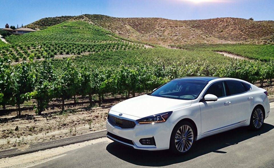
From El Cajon, I followed portions of Historic U.S. Highway 80 east toward the mountains.
Before Interstate 8, Highway 80 was one of the principal roads connecting San Diego with the Imperial Valley, Arizona, and points farther east. The old route stretches roughly 150 miles between San Diego and Yuma, passing through the rolling chaparral, mountain communities, and desert landscapes of East County. Some portions remain drivable, while others have been bypassed, renamed, or cut into disconnected sections by the interstate.
Historic Highway 80 is a reminder of how American roads once worked. Instead of bulldozing straight across the landscape, they followed its contours, passed directly through small towns, and gave travelers a reason to stop.
Near Descanso, I turned north onto California State Route 79. The freeway traffic disappeared almost immediately.
Highway 79 Through Cuyamaca
Highway 79 begins near Interstate 8 and climbs north through the mountains of San Diego County. It passes through Cuyamaca Rancho State Park before sharing a short section with Highway 78 between Julian and Santa Ysabel. Farther north, it reaches Highway 76 near Lake Henshaw before continuing through Warner Springs and toward Temecula.
This southern section of Highway 79 is largely a winding two-lane road. It climbs through oak woodland, open meadows, rocky hills, and stretches of pine forest that bear little resemblance to the crowded coastal cities most people picture when they think of Southern California.
The road demands attention without feeling punishing. There are elevation changes, blind corners, long bends, and occasional straight sections where the landscape opens into broad valleys.
It is the sort of road that makes an ordinary car feel special and a good car feel necessary.
You also begin to understand how much of Southern California exists beyond its freeways. There are ranches, tribal lands, campgrounds, farms, mountain communities, and stretches where the nearest chain restaurant feels several counties away.
Santa Ysabel and the Road to Julian
Highway 79 meets Highway 78 at Santa Ysabel, a small crossroads community surrounded by ranchland and oak-covered hills.
Turn east on Highway 78 and you will reach Julian, the former mining town now best known for apple orchards, antique shops, and pies large enough to alter the handling characteristics of a sports car.
Santa Ysabel itself is worth a stop.
The community takes its name from the Santa Ysabel Asistencia, an inland mission outpost connected to Mission San Diego de Alcalá. The first Mass near the site was celebrated in 1818. By 1822, the asistencia included a chapel, granary, houses, cemetery, and a community of about 450 Native converts. The original structures deteriorated after the secularization of the missions, and the present chapel was built in 1924.
The chapel stands just north of the Highway 78 intersection along Highway 79. It is an easy stop and a reminder that this route follows paths used long before anyone thought to paint double yellow lines across the mountains.
Santa Ysabel is also a good place to find food before continuing north. There are only so many miles a man should drive on historical curiosity alone.
Highway 76 and Lake Henshaw
North of Santa Ysabel, Highway 79 reaches the eastern end of State Route 76 near Lake Henshaw.
Highway 76 runs west from this junction, passing Lake Henshaw before continuing through Pauma Valley and Pala on its way toward Oceanside. The eastern section is quieter and more rural than the heavily traveled portion closer to Interstate 15 and the coast.
For a dedicated driving trip, Highway 76 makes an excellent detour. The road follows the country beneath Palomar Mountain, with access roads leading toward Palomar Mountain State Park and the observatory.
On my trip, I continued north on Highway 79 toward Warner Springs.
The landscape became broader and more open. Grasslands replaced the tighter mountain forest, and long views stretched across the valley. Depending on the day, you may see small aircraft or gliders circling above the old airfield, floating almost silently over a part of California that still feels largely untouched.
Warner Springs and Warner’s Ranch
Warner Springs is a useful stopping point before the road continues toward Oak Grove, Aguanga, and Temecula.
Nearby Warner’s Ranch played an important role in the early movement of people through Southern California. The ranch stood along the southern overland route and was visited by General Stephen Kearny in 1846 and the Mormon Battalion in 1847. On October 6, 1858, the first Butterfield Overland Mail stage stopped there during its 2,600-mile journey from Missouri to San Francisco.
The historic ranch house is located east of Highway 79 along County Route S2. There is not a sprawling tourist complex or a gift shop selling stagecoach-shaped refrigerator magnets. The appeal is the place itself and the realization that travelers were crossing this country long before air conditioning, paved roads, and cupholders.
The Butterfield route connected a chain of stations across the Southwest and California. Warner’s Ranch, Oak Grove, Aguanga, Temecula, Murrieta, and Lake Elsinore were all part of this larger transportation network.
Oak Grove Butterfield Stage Station
Continuing north from Warner Springs, Highway 79 reaches Oak Grove and one of the most significant historic stops along the route.
The Oak Grove Stage Station is one of the few surviving stations associated with the Butterfield Overland Mail. The line operated from 1858 until 1861, connecting California with eastern terminals in Missouri and Tennessee. During the Civil War, the Oak Grove station was also used as a hospital for nearby Camp Wright.
The station was designated a National Historic Landmark in 1961.
I stopped to stretch my legs and take photographs. There is not much spectacle to the building, which is part of its appeal. It is a modest structure beside an old road, built for a time when travel was measured in days rather than estimated arrival times.
Standing there, it was difficult not to think about the contrast between the stagecoach route and the modern highway. I had taken the back road because the freeway was inconvenient. Butterfield passengers would have considered my entire journey suspiciously luxurious.
Highway 79 Toward Temecula
North of Oak Grove, Highway 79 follows the hills through Aguanga and the country east of Temecula.
The road begins to straighten, but it remains rural for much of the journey. Ranch entrances, open land, oak trees, and occasional roadside businesses replace the mountain scenery farther south.
Then the first signs of the metropolitan world return.
Storage facilities appear. Subdivisions climb across former ranchland. Traffic lights multiply. Southern California has a particular talent for announcing urban sprawl several miles before the city itself arrives.
Highway 79 eventually reaches Temecula, where the route overlaps Interstate 15 before continuing north toward Winchester and Hemet. My route, however, turned away from the modern highway system.
I headed through Old Town Temecula and followed the older road north toward Murrieta and Lake Elsinore.
Following Historic Highway 395
The back-road route from Temecula through Murrieta, Wildomar, and Lake Elsinore is not Highway 79. It largely follows the former alignment of U.S. Highway 395.
Historic Highway 395 once ran through Temecula, Murrieta, Lake Elsinore, Perris, and Riverside. In Temecula, the old route follows Old Town Front Street before continuing through a succession of local roads, including Jefferson Avenue, Washington Avenue, Palomar Street, Mission Trail, and Lakeshore Drive.
That distinction may matter mainly to highway historians, a group known for bringing maps to otherwise pleasant dinners, but it makes the journey more interesting.
Old Town Temecula tries hard to preserve its Western character. Historic-looking storefronts stand beside restaurants, bars, boutiques, motorcycles, lifted trucks, and visitors dressed as though they have recently discovered both cowboy hats and expensive sunglasses.
It is not exactly the Old West, but it is lively, walkable, and far more interesting than the nearby freeway exits.
From Temecula, the old highway threads north through Murrieta and Wildomar. Development has swallowed much of the open land that once separated these communities, but sections of the older road still provide an alternative to Interstate 15.
Lake Elsinore’s Forgotten Golden Age
The historic route eventually reaches Lake Elsinore.
Today, it can be difficult to imagine the city as a glamorous resort destination, but during the 1920s, Elsinore became a playground for wealthy visitors, athletes, and Hollywood personalities. The lake hosted high-speed boat racing, while local mineral springs attracted visitors seeking therapeutic treatments.
The old road follows Mission Trail and Lakeshore Drive, tracing the western side of the lake before reaching Highway 74.
Like many California resort towns, Lake Elsinore has gone through cycles of boom, decline, reinvention, drought, and development. Traces of its older identity remain in historic buildings, roadside architecture, and neighborhoods overlooking the water.
It also marks the point where the trip can end or become significantly more ambitious.
Ortega Highway to the Pacific
At Lake Elsinore, Highway 74 heads west across the Santa Ana Mountains on the Ortega Highway.
Ortega is one of Southern California’s legendary driving roads. It climbs rapidly away from Lake Elsinore, twisting through rocky hills, canyons, and stretches of national forest before descending toward San Juan Capistrano.
The highway does not technically deposit you directly onto Pacific Coast Highway in Dana Point. It reaches Interstate 5 in San Juan Capistrano, where local roads continue a few miles toward Dana Point and the coast.
From there, Pacific Coast Highway offers the ultimate California decision.
Turn south for Dana Point, San Clemente, and San Diego. Turn north for Laguna Beach, Los Angeles, and eventually, with enough time and poor regard for schedules, Monterey and San Francisco.
On this trip, I had to return to Interstate 15 and head home. Business, deadlines, and responsibility had finally caught up with me.
But for a few hours, Highway 79 had provided something California’s freeways rarely offer: the pleasure of driving somewhere rather than merely enduring the journey.
Why California’s Back Roads Still Matter
It is easy for automotive enthusiasts to become frustrated with California. Traffic is heavy, regulations are complicated, and the cost of keeping an old car on the road rarely moves in a charitable direction.
Yet few states offer such a remarkable variety of landscapes within a single day’s drive.
Historic Highway 80, Highway 79, Highway 76, old U.S. 395, and Ortega Highway pass through mountains, forests, ranchland, tribal communities, stagecoach routes, mining towns, historic districts, resort towns, and coastal cities.
The roads are not simply ways to reach a destination. They are part of the story.
You can leave a client meeting in suburban El Cajon, climb into the mountains, pass an old mission outpost, follow the Butterfield stage route, eat in a Western town, circle a former Hollywood playground, and finish beside the Pacific Ocean.
That is why California remains difficult to abandon completely.
The state may test the patience of anyone who loves cars, but every so often, it hands you the keys to a road like Highway 79 and reminds you why you started driving in the first place.
California Highway 79 Road Trip Quick Facts
- Starting point: El Cajon or Descanso, California
- Primary route: Portions of Historic U.S. 80 followed by California State Route 79
- Northern back-road continuation: Historic U.S. 395 through Temecula, Murrieta, Wildomar, and Lake Elsinore
- Optional side route: Highway 76 west past Lake Henshaw toward Pala and Oceanside
- Optional coastal finish: Highway 74, also known as Ortega Highway, to San Juan Capistrano and the Dana Point area
- Major stops: Cuyamaca, Julian, Santa Ysabel, Lake Henshaw, Warner Springs, Warner’s Ranch, Oak Grove, Temecula, Lake Elsinore, and San Juan Capistrano
- Road type: Mostly two-lane mountain and rural highway, with urban sections near Temecula and Lake Elsinore
- Best seasons: Spring and fall generally provide comfortable temperatures and good scenery
- Fuel and services: Available in the larger communities, but services can be limited along the rural sections
- Best vehicle: Any well-maintained car will manage the route, although a responsive sports car, classic car, or motorcycle makes the curves considerably more entertaining
- Travel warning: Mountain weather, wildfires, construction, and temporary closures can affect these roads. Caltrans currently has a widening and safety project underway on Highway 74 near Lake Elsinore, with possible delays and extended closures during some construction periods. Check current conditions before departing.
Frequently Asked Questions
Is Highway 79 a good Southern California road trip?
Yes. Highway 79 offers winding roads, mountain scenery, historic sites, rural communities, and access to Julian, Santa Ysabel, Lake Henshaw, Warner Springs, and Temecula. It is one of the best alternatives to the major freeways in inland San Diego County.
Does Highway 76 connect with Highway 79?
Yes. The eastern end of Highway 76 meets Highway 79 near Lake Henshaw. Highway 76 continues west through Pauma Valley and Pala before eventually reaching Oceanside.
Does Highway 79 go through Julian?
Highway 79 shares a short section with Highway 78 between Julian and Santa Ysabel. Drivers must follow the marked turns through Julian to remain on Highway 79.
What is the historic road between Temecula and Lake Elsinore?
The older back-road route between Temecula and Lake Elsinore largely follows Historic U.S. Highway 395. Portions use Old Town Front Street, Jefferson Avenue, Washington Avenue, Palomar Street, Mission Trail, and Lakeshore Drive.
Can you take Ortega Highway from Lake Elsinore to Pacific Coast Highway?
Highway 74 crosses the mountains from Lake Elsinore to San Juan Capistrano. It ends near Interstate 5, but local streets provide a short connection to Dana Point and Pacific Coast Highway.
How much time should I allow for this road trip?
Allow most of a day if you plan to stop in Santa Ysabel, visit Warner’s Ranch or Oak Grove, explore Old Town Temecula, and continue to Lake Elsinore. Adding Highway 76, Julian, or Ortega Highway can easily turn it into a full-day or weekend drive.
When is the best time to drive Highway 79?
Spring and fall usually provide the most comfortable weather. Summer can be hot around Warner Springs and Temecula, while winter storms may bring rain, fog, ice, or snow to the higher elevations near Cuyamaca and Julian.